
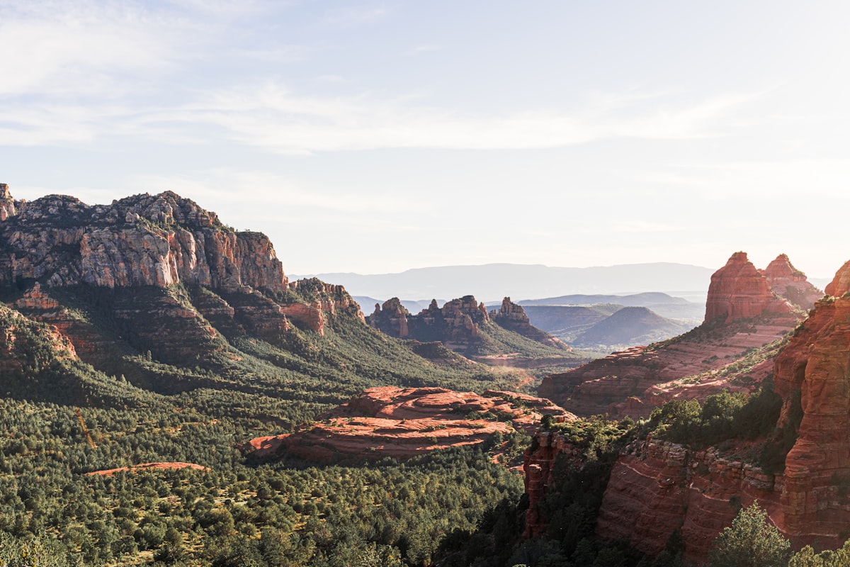
 Sedona Hiking Trails
The 5 Best Beginner Hikes in Sedona
By Rupa Chenthil · Published May 18, 2026 · 6 min read
Sedona's most famous hikes — Devil's Bridge, Cathedral Rock, Bear Mountain — get the photos, but they're not where beginners should start. These five trails deliver classic red-rock views without scrambling, exposure, or an all-day commitment. We send our first-time guests to this list before anything else, and every one of them comes back ready (and physically able) to tackle a harder route the next day.
A note before you start: Sedona sits at roughly 4,350 feet. If you've flown in from sea level, your first 24 hours will feel harder than the trail rating suggests. Drink water on the plane, take it slow on day one, and save the steeper hikes for day two or three. The Coconino National Forest manages the trails listed below, and the comprehensive trail catalog at visitsedona.com/things-to-do/hiking is the most up-to-date source for closures, conditions, and seasonal restrictions.
1. Bell Rock Pathway (1.0–3.6 miles, easy)
An almost-flat, well-graded path that loops around the base of Bell Rock and Courthouse Butte. You can do as little as a mile or stretch it to a full loop. Big views of two iconic formations the entire way, and a great option for kids, older guests, or anyone easing into the elevation.
Trailhead: Bell Rock Vista, Highway 179 (Village of Oak Creek). GPS: 34.8005, -111.7686. Roughly 28 paved parking spots plus a long shoulder overflow.
When the lot fills: By 8:30am on weekends from March through May, and again from late September through early November. On a weekday in summer you can usually roll in at 10am and still find a space. Red Rock Pass required ($5/day or $15/week), available at the kiosk on-site (cash or card).
Kid & dog rating: Strollers do well on the first half-mile of the paved spur; dirt sections beyond are stroller-tolerant but bumpy. Dogs on leash are welcome the entire route. Bring a collapsible water bowl — there is no creek anywhere on this trail.
2. Fay Canyon Trail (2.4 miles, easy)
A shaded, sandy walk into a box canyon framed by towering walls. Almost no elevation gain. The end of the trail opens into a quiet bowl that feels enclosed and cathedral-like — and there's an optional scramble to a small natural arch about halfway in if you want to add a challenge.
Trailhead: Fay Canyon trailhead on Boynton Pass Road, about 20 minutes from West Sedona. GPS: 34.9075, -111.8444. The lot is small (roughly 18 spaces) and fills by 9am on weekends.
The arch detour: About 0.6 mile in, a small cairn on the right marks a faint use trail that climbs steeply for ten minutes to a natural sandstone arch hidden against the canyon wall. The scramble is short but uses your hands. Skip it with young kids or anyone uncomfortable on slickrock; the main trail rejoins seamlessly.
3. Templeton Trail to Cathedral Rock View (3.0 miles, easy-moderate)
The non-scrambly way to "see" Cathedral Rock. Templeton parallels Oak Creek and the back side of Cathedral, with several creek-crossing photo spots and a perfect side-on view of the spires from below. You get the postcard without the cliff.
Trailhead: Baldwin trailhead at the end of Verde Valley School Road. GPS: 34.8155, -111.7942. Note the lot has been chronically full since 2024; if you can't get in, walk in via the connector from Yavapai Vista (adds 1.2 miles round trip) or take the Sedona Shuttle from the Posse Grounds Park & Ride.
Best view spot: Roughly 0.9 mile in, the trail climbs a low ridge and Cathedral fills the western horizon. We tell guests to keep walking another 200 yards past the obvious overlook — there's a quieter bench-shaped slab that almost nobody finds, with a cleaner line of sight to the spires.
4. Boynton Canyon Vista (1.2 miles, easy)
A short spur off the main Boynton Canyon Trail that climbs to a small saddle with sweeping views of one of Sedona's most spiritually significant canyons. Great sunset hike. Bring a layer — the saddle catches a steady evening breeze.
Trailhead: Boynton Canyon trailhead, end of Boynton Canyon Road. Watch for the signed Vista spur about 0.25 mile in on the right; missing it sends you on the much longer (7-mile round-trip) main canyon hike, which is wonderful but not a beginner outing.
Sunset timing: Aim to be at the saddle 30 minutes before the published sunset — the light gets dramatic for about 20 minutes, then drops fast. Headlamp non-negotiable for the descent in winter; in summer you'll have enough afterglow to walk down comfortably.
5. Sugarloaf Loop (1.9 miles, easy)
A tidy little West Sedona loop that climbs Sugarloaf summit for a near-360° view of West Sedona, Capitol Butte, and the Coffee Pot formation. Closest trailhead to many of our West Sedona rentals — guests routinely walk to it from the house.
Trailhead: Sugarloaf trailhead off Coffee Pot Drive, GPS 34.8770, -111.7853. Tiny neighbourhood lot (roughly 10 spaces). Be respectful: this is a residential street, do not block driveways or park on the lawns, and keep voices down at sunrise.
Why we love it: The summit is the cheapest sunrise in Sedona — under 25 minutes from car to top, no scrambling, 360° of red rock and city lights still on in the valley. We send guests here on their first morning to "calibrate" before deciding what kind of day they want.
Weather windows by season
The best hiking window is reliably March–May and again September–November, but Sedona is a year-round destination if you adjust your start time. The detailed monthly climate breakdown at visitsedona.com/trip-planning/weather is the most accurate forecasting reference; we cross-check it against the local NWS Flagstaff office for storm tracking.
- Summer (June–August): Be at the trailhead by 6am or wait until after 5pm. Surface temps on exposed red rock routinely exceed 130°F and have caused serious heat injuries every year. Monsoon thunderstorms build in late July and August — never enter a slot canyon (Fay) with rain in the forecast.
- Winter (December–February): Clear, crisp, often empty trails. Daytime highs in the 50s, nighttime lows in the 20s. Snow is possible on north-facing sections of Bell Rock and Cathedral; carry microspikes if you're hiking January–February.
- Shoulder (March, October–November): The sweet spot. 65–75°F days, light crowds, long golden-hour windows. Trailheads still fill by 9am on weekends.
What to bring on every hike
- Water — minimum 1L per person on short hikes, 2L for anything over 2 miles. Sedona's air is desert-dry and you will dehydrate without noticing.
- Sun protection — wide-brim hat, polarised sunglasses, mineral SPF 30+. The red rock acts like a reflector and burns the underside of your nose.
- Trail shoes, not sneakers. The sandstone gets glass-slick when dusty, and a stiff sole protects against the prickly pear spines that show up trail-side.
- Red Rock Pass — $5/day, $15/week, $20/annual. Available at the trailhead kiosk, any visitor center, or buy online ahead. Without it you risk a $100 federal citation.
- Offline trail map — AllTrails Pro or onX Backcountry. Cell coverage drops 30 yards off the highway on most trails.
- Snack with salt — pretzels, salted nuts, or electrolyte tabs. Plain water at altitude can actually deplete sodium faster than it replaces it.
Trail etiquette that locals notice
- Yield uphill — hikers climbing have right of way over those descending.
- Stay on the slickrock or the established tread. The crusty soil beside the trail (called cryptobiotic crust) takes 50+ years to rebuild after one footstep.
- Pack out everything, including apple cores and orange peels. They don't biodegrade in desert air the way they do in temperate climates.
- Voices carry in canyons. The person 200 yards behind you can hear your music.
- Mountain bikers and equestrians have right of way over hikers on multi-use trails; step off the trail on the downhill side.
If you only have an hour
Do the Sugarloaf loop from the Coffee Pot Drive trailhead. Twenty-five minutes up, ten minutes at the summit for photos, twenty minutes down. You'll have driven less time than you hiked, and the summit view from Sugarloaf is honestly competitive with the trails that require three hours and a permit. For more curated micro-itineraries built around limited time, the official hiking directory sorts trails by distance and elevation so you can match available time to terrain.
Start with these five and you'll have a feel for Sedona's terrain before you tackle Devil's Bridge or Cathedral Rock. Your knees and your photos will both thank you — and you'll come away with the un-Instagrammed bits of Sedona that the famous hikes don't show.
Where to stay in Sedona
Make a weekend of it — base your trip at one of our luxury Sedona vacation rentals, each with a private hot tub, red-rock views, and room to unwind after the trail.

More in Sedona Hiking Trails
Plan your Sedona stay
Browse our hand-picked vacation rentals — book direct and save vs Airbnb / Vrbo.
View Properties