
Airport Loop Trail: The Mesa Circumnavigation
The Airport Loop is a 3.3-mile circumnavigation of the entire Airport Mesa, with about 400 feet of elevation gain spread across a varied route that climbs onto slickrock benches, traverses the quieter back side of the mesa, and returns past the famous vortex saddle. It is a much better hike than the popular vortex overlook suggests.
Trail overview
The Airport Loop encircles Airport Mesa for 3.3 miles with 400 feet of cumulative elevation gain. Counter-clockwise is the preferred direction; the views unfold better that way, starting with the back-side perspective of Capitol Butte and Coffee Pot Rock and finishing with the dramatic southeast vista back toward Cathedral Rock and Bell Rock. Most groups finish the loop in two hours at a moderate pace.
What to expect
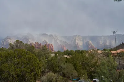
The trail starts from the upper Airport Mesa parking area on Airport Road and immediately leaves the crowds behind — most of the visitors at the upper lot walk the short out-and-back to the vortex overlook and never see the full loop. Going counter-clockwise, the trail drops gently into the saddle on the north side of the mesa, traverses the back side under the airport runway (you can hear the small commercial flights overhead but the trail itself is remote-feeling), then climbs gradually around the east end of the mesa with the entire Sedona red rock skyline opening up. The final stretch passes the vortex overlook on the high south side before returning to the parking area.
The traverse under the runway is genuinely interesting — small Cessnas and the occasional commercial flight come in low overhead, and the contrast of an active airport above a quiet desert trail is unique to this hike.
Permits + parking
Three lots on Airport Road serve this trail. The upper lot is smallest and fills first; the scenic overlook lot is time-limited; the airport long-term lot is paid hourly but never full. Red Rock Pass required at all three ($5 day) plus the airport lot\'s separate hourly fee. See our dedicated Airport Mesa vortex page for parking details.
Best time to go
Sunset (counter-clockwise so the final stretch is on the east-facing side as the rocks light up). Sunrise is also excellent and far less crowded. Avoid midday in summer — the loop is fully exposed and there is no shade.
Difficulty + safety
Easy-to-moderate. The 400 feet of elevation is spread out so no single section is hard. Carry 1.5 litres of water per person. Dogs welcome on-leash. The trail is well-marked but the upper sections have substantial drops on the mesa-edge side; keep children well back from the edge.
Loop vs vortex overlook
The two experiences on Airport Mesa are completely different. The vortex overlook (5-minute walk from the upper lot) is the crowded sunset spot — atmospheric, but packed shoulder-to-shoulder on weekends. The full Airport Loop is the hike — quiet, varied, and the right call if you want to actually feel like you went somewhere. Many of our guests do both in the same outing: arrive 90 minutes before sunset, walk the loop counter-clockwise so you finish at the vortex overlook for the actual sunset, then descend back to the car. The combined outing takes about 2 hours and gives you the best of both Airport Mesa experiences in one trip.
Stay nearby
Airport Mesa is a five-minute drive from our West Sedona properties. See our Sedona vacation rentals for properties within easy reach, and check Visit Sedona for current trail conditions.